art-and-tours-berlin
Email: mvost@gmx.de
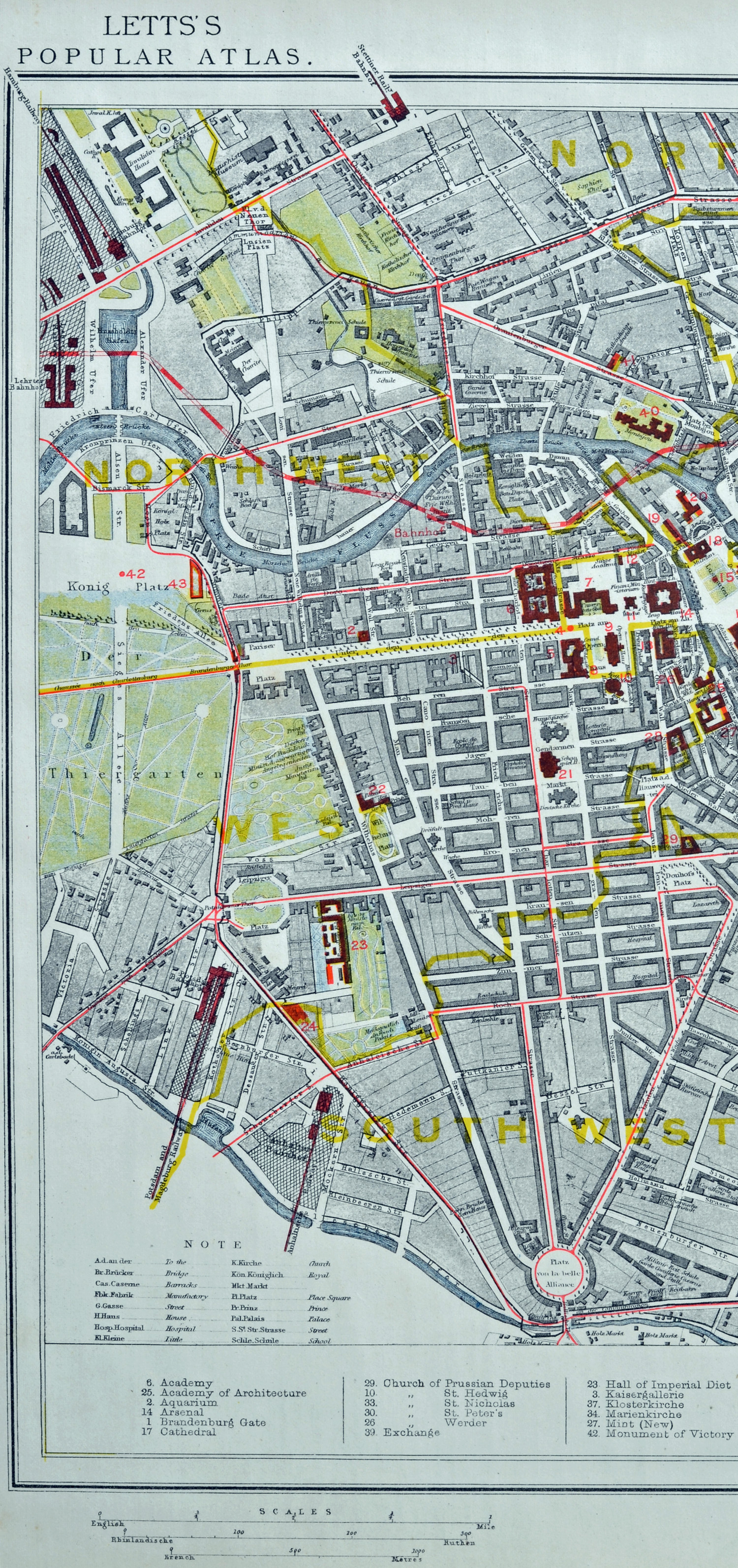
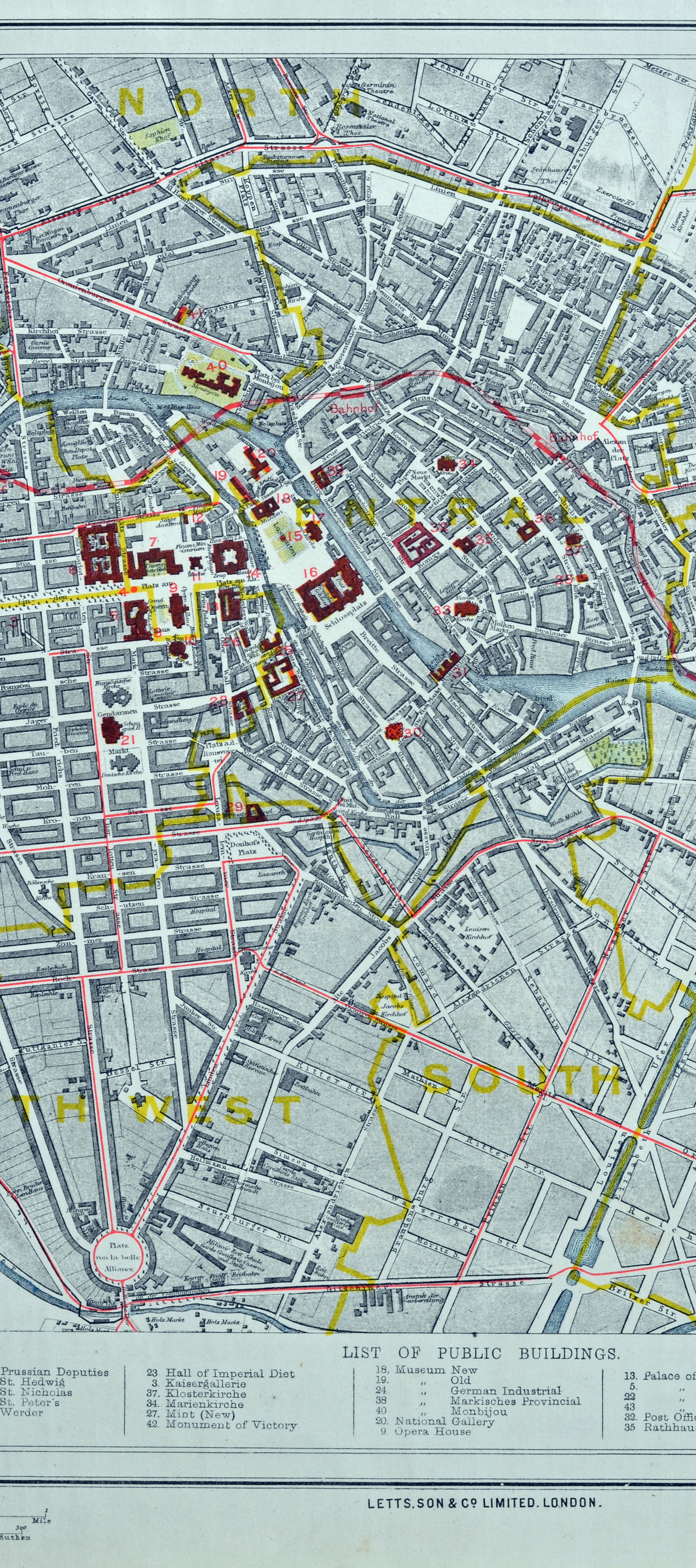
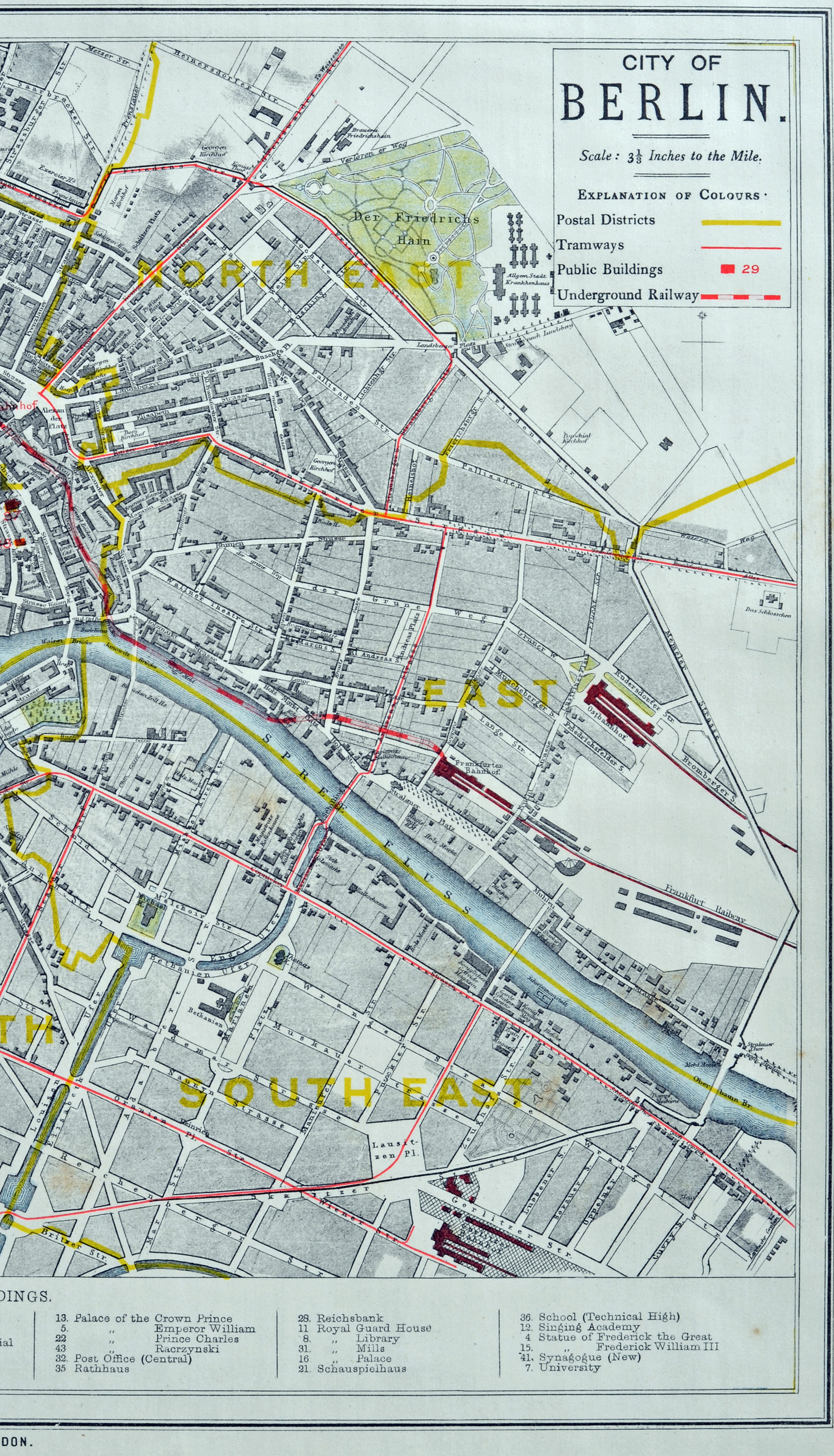
Berlin Stadtplan 1883
(Lithografie von Letts.Son & Co, London 1883, Plangr. 27,0 x 38,0 cm, Blattgr. 35,5 x 43,7 cm, Lett's Popular Atlas, London 1883), Günther Schulz: Die Stadtpläne von Berlin 1652-1920, Nr. 881.
Plan von 1883 in drei Abbildungen
1. Bild, linkes Plandrittel mit den Postdistrikten: North, Northwest, West, Southwest
2. Bild, mittleres Plandrittel mit den Postdistrikten: North, Central, Southwest, South
3. Bild, rechtes Plandrittel mit den Postdistrikten: Northeast, East, Southeast