art-and-tours-berlin
Email: mvost@gmx.de
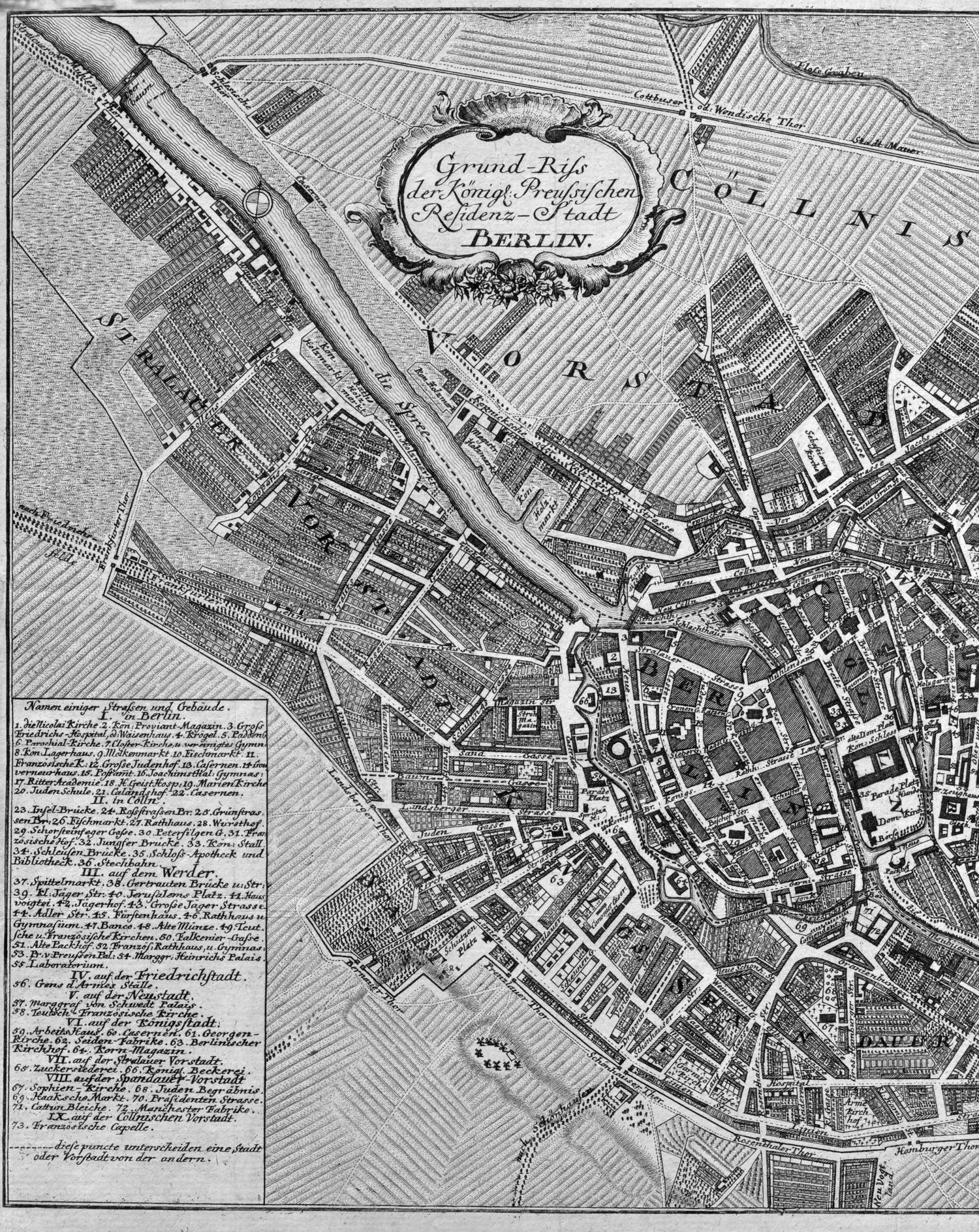
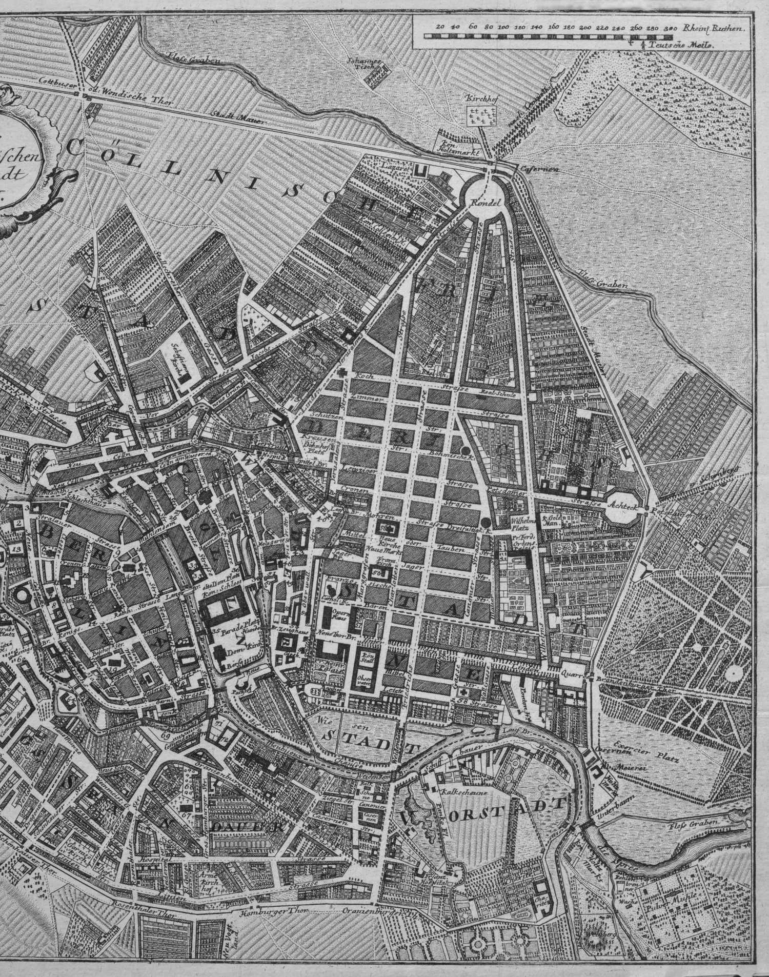
Berlin City Map 1769
(City map from the first description of Berlin by Friedrich Nikolai: Grund-Riss der Königl: Preussischen Residenz-Stadt Berlin. Berlin, Nicolai, 1769; copper engraving after Schleuen, picture detail 27,5 x 35,5 cm, paper size 31 x 37,5 cm), Günther Schulz: Die Stadtpläne von Berlin 1652-1920, No. 133.
The city map is divided here in two parts
1. part, left part ot the city map: Stralauer Vorstadt Königsvorstadt, Berlin und Cölln;
2. part, right part: Berlin, Cölln, Friedrichswerder, Spandauer Vorstadt. Dorotheenstadt, Friedrichstadt;
In this city map of the 18th centuy southern direction is lying at the top.