art-and-tours-berlin
Email: mvost@gmx.de
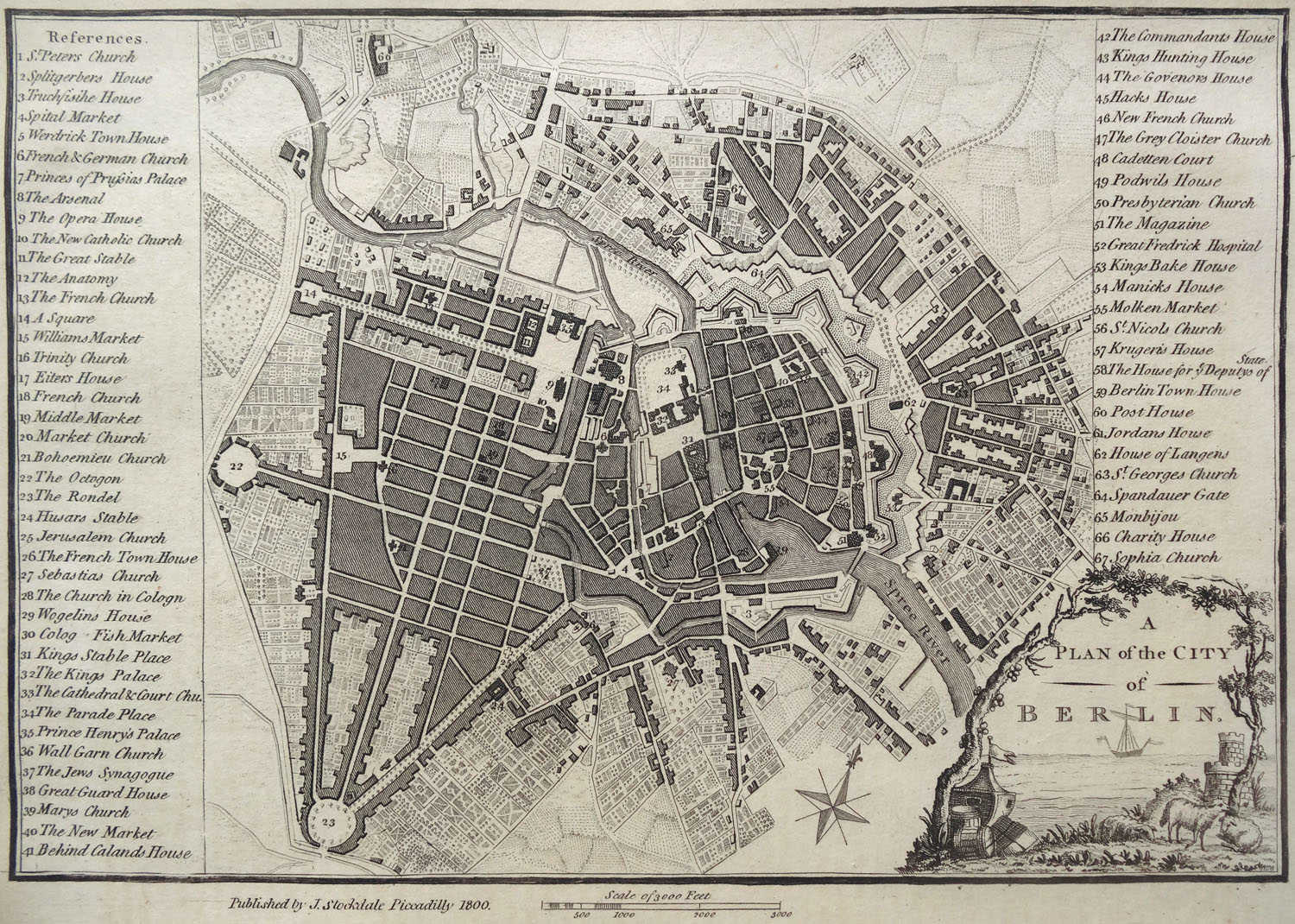
Berlin City Map 1748, printed by Stockdale in 1800 after the Schmettau city map from 1748
Minimised copper engraving of the Schmettau city map of 1748, with 67 mentioned buidlings and squares, published by Stockdale in 1800 in London, (paper size 22,3 x 29,0 cm cm, picture detail 17,2 x 25,4 cm), Günther Schulz: Stadtpläne von Berlin 1652-1920, No 101.
Northern direction is lying at the top.