art-and-tours-berlin
Email: mvost@gmx.de
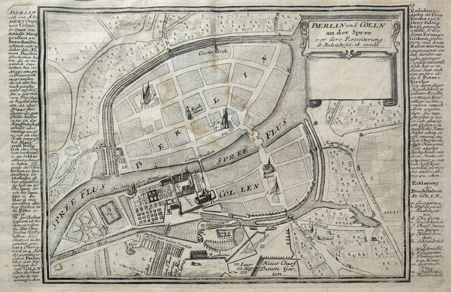
Berlin City Map 1652. printed 1720-27
Minimised copper engraving of the first city map of Berlin designed by Gregor Memhardt 1652, executeted between 1720 and 1727 by Gabriel Bodenehr the Older for the collection of 200 city maps of fortifications in Europe published in Augusburg between 1720 and 1727 under the title Force d'Europe (paper size 19,0 x 30,0 cm, picture detail 17,2 x 23,0 cm, ), Günther Schulz: Die Stadtpläne von Berlin 1652-1920, No. 4.
The city map of 1727 shows the city of Berlin 75 years earlier in the year 1652 without the new laid out part of Dorotheenstadt and Friedrichstadt; eastern direction is lying at the top.