art-and-tours-berlin
Email: mvost@gmx.de
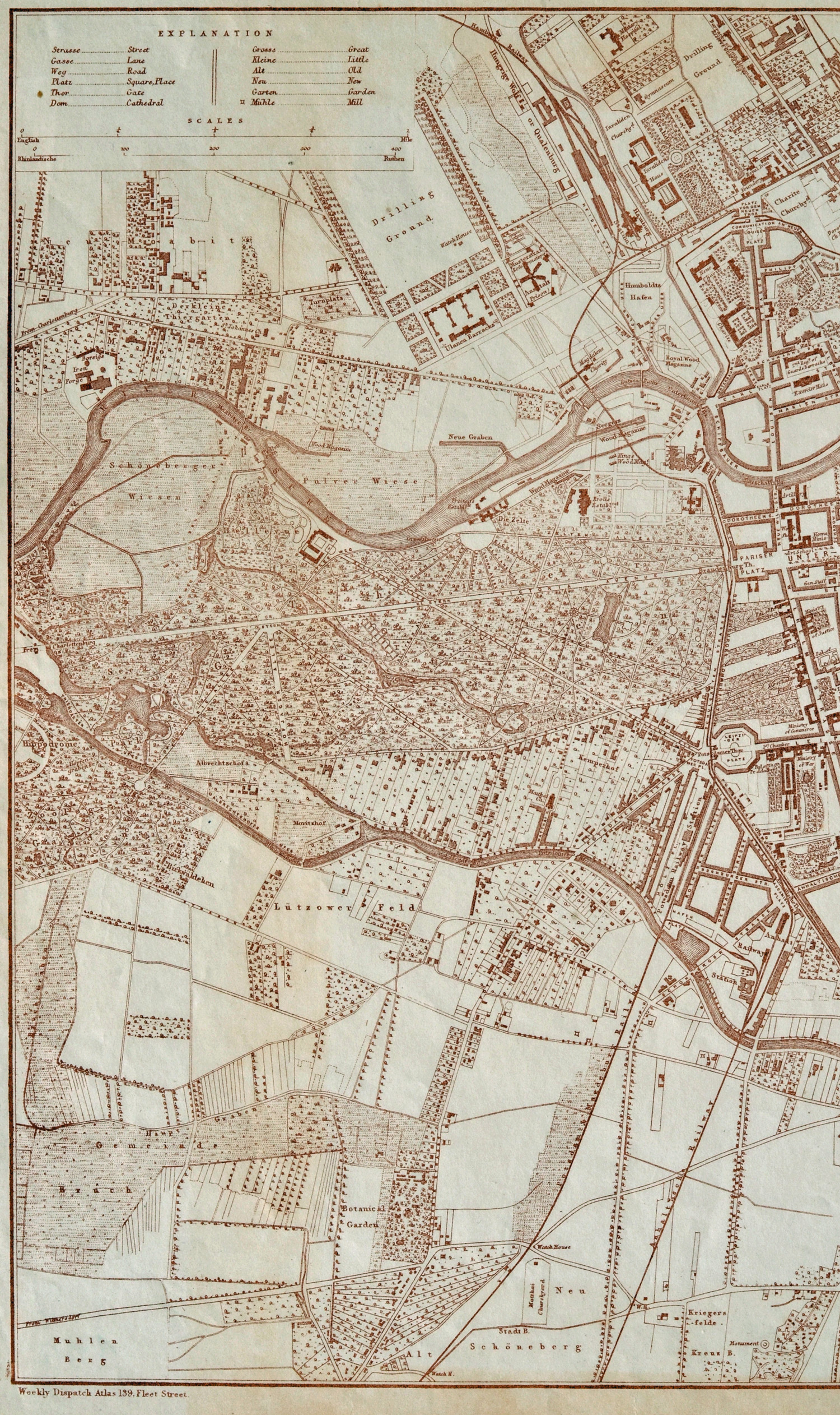
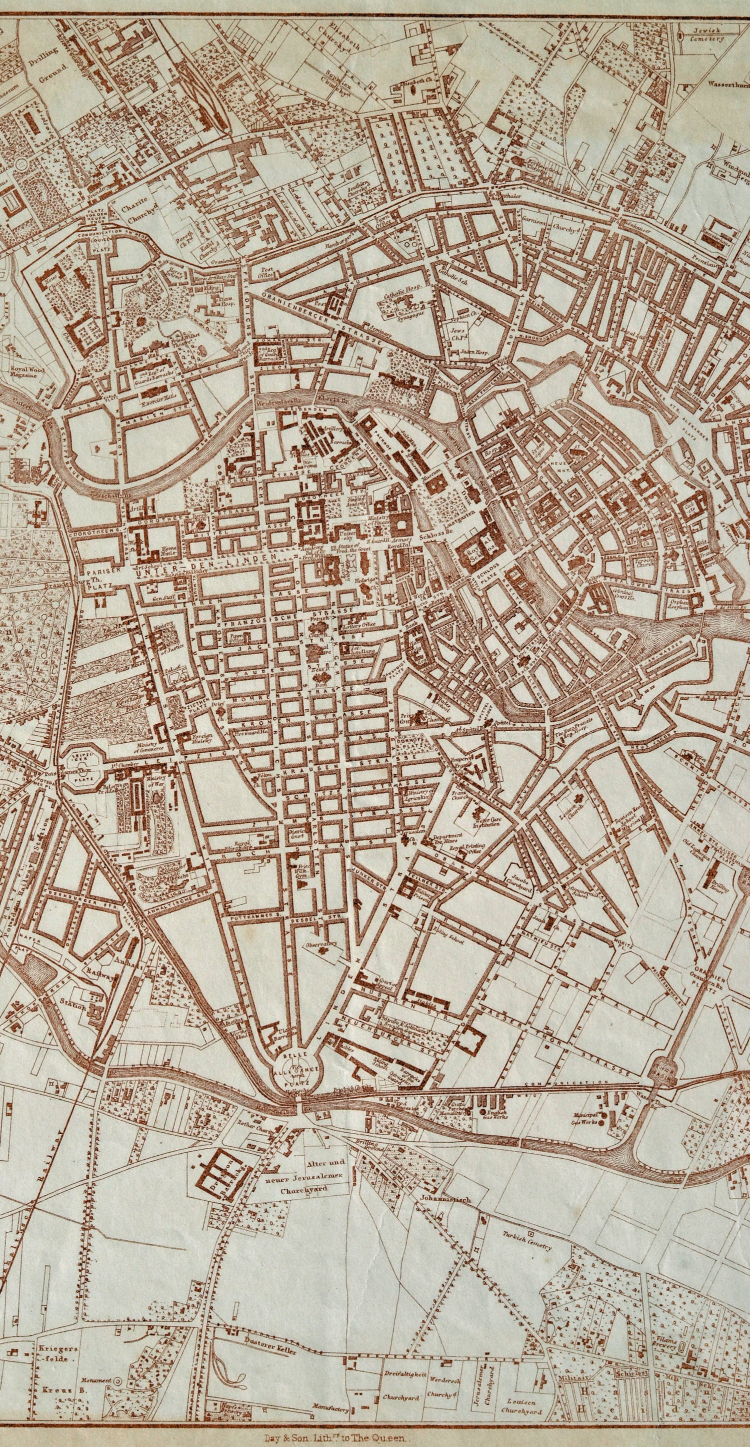
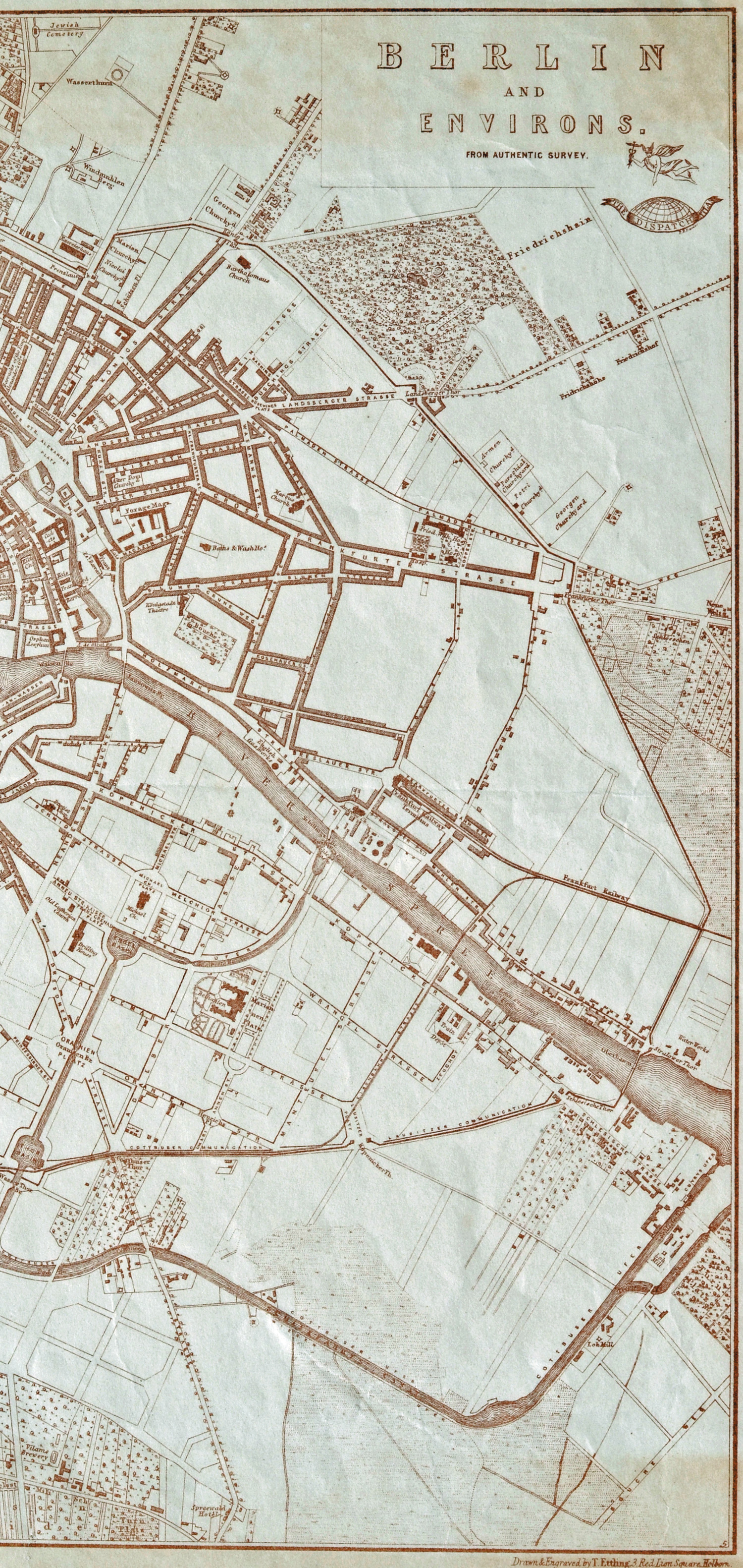
Berlin City Map 1857
(Lithograph after Ettling, Day & Son, map size 30,5 x 43 cm, paper size 31,5 x 47 cm, Berlin and Environs, from authentic survey, Day & Son, London 1857), Günther Schulz: Die Stadtpläne von Berlin 1652-1920, Nr. 552.
The city map is divided in three parts
1. part, left part ot the city map with the districts: Tiergarten, Schöneberg, parts of Mitte
2. part, center part with the districts: Mitte with Berlin and Cölln, Friedrichstadt, Dorotheenstadt, Spandauer Vorstadt, Kreuzberg
3. part, right part with the districts: Prenzlauer Berg, Friedrichshain, Luisenstadt