art-and-tours-berlin
Email: mvost@gmx.de
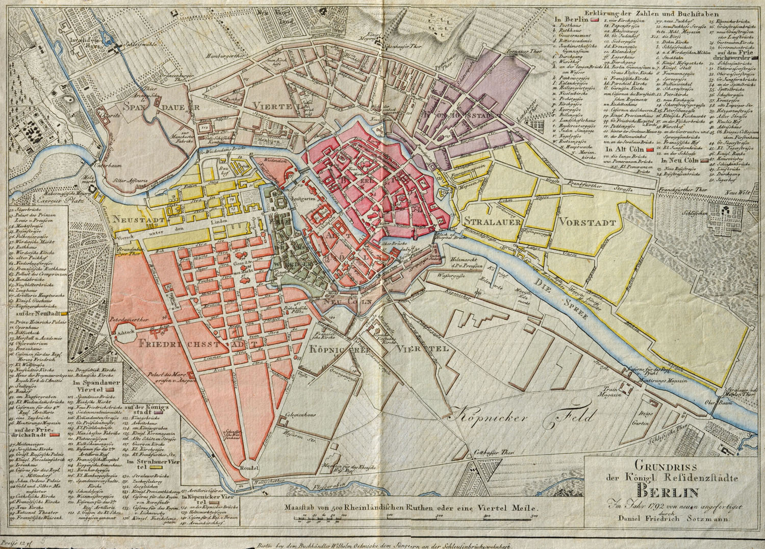
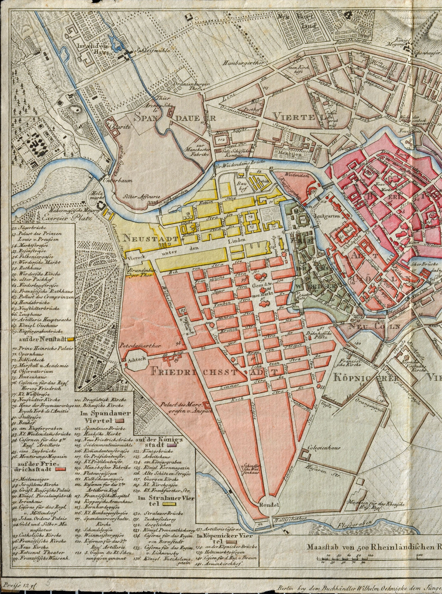
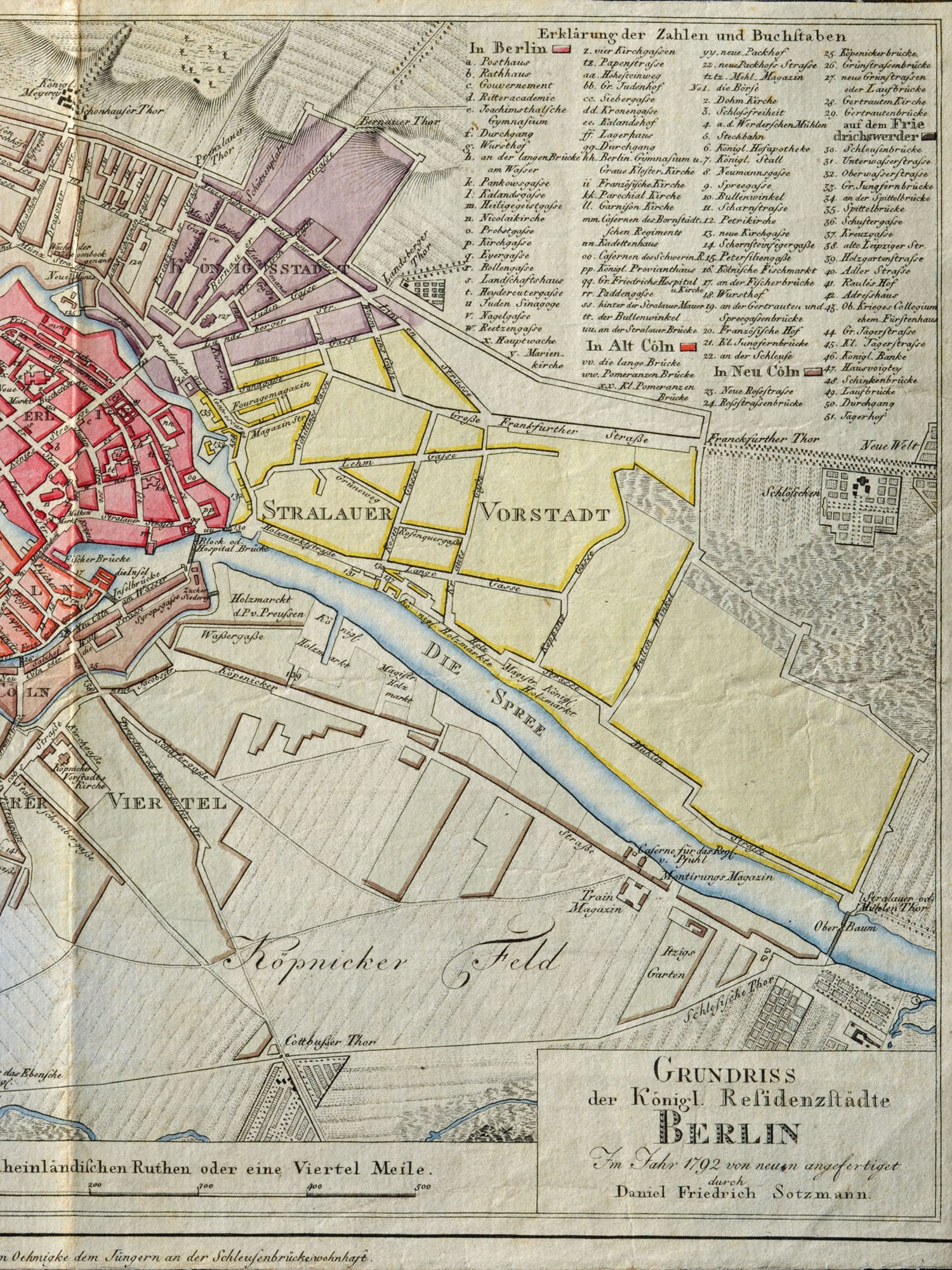
Berlin City Map 1792
Copper engraving by Daniel Friedrich Sotzmann, Berlin 1792, map size 30,7 x 18,8 cm, paper size 31,6 x 22,5 cm, Grudriss der Königl. Residenzstädte Berlin im Jahre 1792, Günther Schulz, Stadtpläne von Berlin 1652-1920, Nr. 191.
The city map is shown here in three parts
1. part, whole of the Berlin city map 1792
2. part, left part of the city map Berlin 1792
3. part, right part of the city map Berlin 1792